
Destinations:
Bowser Fire Watch Tower
Bowser Lake Cabins
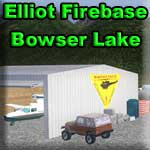
Elliot Fire Base
Route Briefing
- This Scenery is for "Return to Misty Moorings" only.
- Suggested Altitude: See Altitude Notams in Plan
- Landing zone is: Water (Freezes in Winter) or Land
- GPS for destination: N56 25.31 - W129 43.29
- Distance approximately: 32.4 miles
- Download PRINT-ABLE copy HERE <=XXX
- Flight-Seeing Flight Plan & Map HERE <=XXX
Bowser Lake Locations
Bowser Lake has three close-by destinations: (1) the cabins, (2) Elliot Fire Base and (3) the Watch Tower. The VFR plan below will guide you to all three. You will be leaving Stewart and flying part of the Bear River, going high over Eagle Pass, then dropping back down to Bowser Lake. This is a beautiful and mountaineous trip.
NOTAM: If weather conditions are poor, low visibility at altitude, do not attempt this trip. This is for good visibility days only.
WaveTop VFR Plan
FROM : Stewart Airport (CZST)
TO: Bowser Lake Locations
This trip begins at the Stewart Airport. Try to take of from Runway 36, the direction of the flight plan. If you must take off on 18, then you will go out over the water, make a "U" turn and come back over the airport to intercept the flight plan.
- Our flight begins in Stewart, BC. Stewart's setting can only be described in superlatives, combining an oceanfront location with alpine scenery, glaciers, ice fields, and spectacular waterfalls. This setting and the outdoor recreation opportunities it offers, contribute in an important way to the communities lifestyles. The area offers, fresh and saltwater fishing, boating, hiking, cross country skiing, snowmobiling, and numerous other activities.
- Stewart's colorful history has been dictated by the fortunes of the mining industry. The first exploration in the area took place in the late 1890's and the town site was named in 1905. An estimated 10,000 people resided in the area in the early 1900's, attracted by the prospects of gold; yet during World War I the population was reduced to less than twenty. Stewart was founded by two Scottish brothers, John and Robert Stewart.
- Major mines such as Premier Gold, Big Missouri and Granduc Copper have been established in the Stewart area. These projects created the impetus for population increases and attracted a skilled work force to the community. Mining is also primarily responsible for the development of support services such as heavy duty mechanics, welding shops, and transportation-related businesses, which provide service to all the basic resource industries. Today employment in the community is much more broadly-based and includes opportunities in transportation, mining, logging, retail and hospitality sector, and public administration.
- As a contact zone between the Coast Range Batholith and sedimentary formations to the east, the Stewart area is highly mineralized and contains proven reserves of a wide range of precious and base metals including gold, silver, copper, lead and zinc
Leg: Stewart Airport to River Corner
Initial Course: 354
Leg Distance:
10.3 miles
When on the flight plan heading north of Stewart Airport, we will be flying up the Bear River Valley. About 10 miles ahead, Mt. Johnson blocks our path and the valley forks to port and starboard. We will be taking the port fork at River Corner.
- Over the mountains to port are the major glaciers in the area, Chicamin, Boundary, Greenpoint ... They are all there starting about 5 miles to the west of your position. RTMM has created a series of "Ice Stations" out on these glaciers that you can visit. In the summer, we may be flying in a lush valley here now, but even in summer, above us to the left and right is winter, year around! The glaciers are a beautiful thing to see, and a must visit with your trip to this part of the world.
- As we approach Mt Johnson ahead, we are flying over 17A, the Stewart Highway. The roadway follows the Bear River. When we get to Mt. Johnson, you will see the river and the road bear off to the right, we will be going to the left, climbing to High Pass, one of the highest mountain passes in this area.
Leg: River Fork to River Valley
New Course: 326
Leg Distance: 5.4 miles
Leg Altitude: 2500
Where the valley forks, you will take the port fork and fly the center of that valley, climbing steeply to make the altitude you will need at High Pass. You should have an altitude of 2500 feet on this leg. Continue to follow the valley.
- About six miles away on our left, on the top of the mountains here is Salmon Glacier, you may get a glimpse of it as our altitude climbs to about 2500 feet here.
Leg: River Valley to Kimball Lake
New Course: 009
Leg Distance: 5.4 miles
Leg Altitude: Climb to 6500 feet.
The valley now takes a slight bend to the right. Now begin to climb to about 6500 feet. You should see a "flat" mountaintop soon to your port ... and two small lakes below. Keep climbing, to 6500 feet as you'll have to clear "high pass" ahead.
- We are now following the valley for American Creek. You will notice we are climbing to be able to fly over High Pass. American Creek flows from the high mountain Kimball Lake, a pocket in the mountain that holds the cold glacier runoff water before it flows on down to the Bear River and Stewart.
- The high mountain coming up to your left is Mt. Jancowsk.
Leg: Kimball Lake to High Pass
New Course:
Leg Distance:
Leg Altitude: 6500
Ahead is "High Pass" ... twin mountain peaks, you will fly through the notch between them and must be at an altitude of about 6500 feet.
- Ahead, you will see we are climbing to go over High Pass. The pass is about 5500 feet in altitude and we will be going over it at about 6500 feet. This will give you a glimpse of the starkness and unreal beauty of the glaciers beyond to the left and right.
Leg: High Pass to Gulch Cliff
New Course: 009
Leg Distance: 2.9
Leg Altitude: Begin Safe decent to 1200 feet
After High Pass, start a descent. After High Pass, slow down and start your descent. Look up ahead and you will see the valley and river turning to starboard. Be down to about 1200 feet as you make that turn.
- We are now decending to the Bowser River Valley ahead. The river is formed by glacial runoff from the glaciers to port, it flows down the valley you see ahead. The river is flowing to the right and is the source of water for the very large Bowser Lake that you will see when we make the turn over the river in the valley ahead.
Leg: Gulch Cliff to River Turn
New Course: 010
Leg Distance: 1.7 miles
As you near the end of this leg, you should be down to about 1200 feet when you make the turn into the valley only 1.7 miles ahead.
Leg: River Turn to Bowser Lake
New Course: 039
Leg Distance: 4.1
When you get to the river, turn to starboard to 039. The landing zone for the Elliot Fire Base and Bowser Lake Cabins is 4.1 miles ahead. Get into landing configuration and land on the grass strip there ... OR ... if so equipped, you can land in front of the cabins at the leading edge of Bowser Lake.
- If you would like to see the fire tower, you will find it on a heading of 331 from the fire base at a distance of about 2.1 miles, high on the mountain there. On a good visibility day, this little side trip is worth the effort.
- A little about Bowser Lake Cabin It is located on a small island on the far Western shore of Bowser lake, this cabin is open for visitors all year long. Built on stilts in 1954, it is showing it's age along with it's twin cabin which is operated by the forestry service. The twin cabin is just south on the same shoreline. Visitors here in the winter enjoy ice fishing and hunting along with hiking, mountain climbing and other winter sports activities. The cabin has a floatplane dock only open during the spring, summer and early fall seasons. In the winter, this lake has the tendency to freeze over making only ski plane operations here possible. The nearby gravel airstrip of Bowser Lake is only a short hike away for the daring. Just be sure to take precautions for bears here. They frequent the river delta that feeds into Bowser Lake and chances are very good that you'll see some here.
- The Elliot Firebase is here for a good reason! Each day during the time of year when fires are most likely to be a threat, this airstrip comes alive. Elliot Fire Base is a short flight from Stewart (CZST) and is situated at the Bowser Lake airstrip. All firefighting efforts in the region are coordinated from here. There are two helicopters that are based here and their pilots are on call during the day to coordinate fire watch alerts. There are also two forestry service spotters on call and they share a nearby lakeshore cabin with the two chopper pilots. The cabin is close enough that the crew can quickly reach the airstrip when a fire is reported.
- The watch tower is about 2.1 miles from here on a bearing of 330 degrees, you will need binoculars to see it. Helicopters from the fire base take the people back and forth to man the watch tower in the fire season.
- We hope you enjoyed your trip to the Bowser Lake Area. There is more to see in this area, especially the glacier tours that you can get at Ketchikan Airport.
Welcome to Bowser Lake!
Doug Linn
Charter Manager
Misty Moorings, Inc
contact@mistymoorings.com
(Revised 07.05.2012)